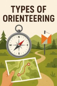
Different Types of Orienteering Courses
Contents
- 1 Different Types of Orienteering Courses
- 1.1 Foot Orienteering
- 1.2 Trail Orienteering
- 1.3 Sprint Orienteering
- 1.4 Mountain Bike Orienteering (MTB-O)
- 1.5 Ski Orienteering (Ski-O)
- 1.6 Rogaine Orienteering or Score Orienteering
- 1.7 Night Orienteering (Night-O)
- 1.8 Park and Street Orienteering (Urban)
- 1.9 Adventure Racing Orienteering
- 1.10 Canoe Orienteering (Canoe-O)
- 1.11 Orienteering that is Designed for Young Children and Schools
- 1.12 Project Orienteering
- 1.13 String Orienteering
- 1.14 Relay Orienteering
- 1.15 Star Orienteering
- 1.16 Conclusion
- 1.17 Compass Basics for Orienteering: How to Navigate Like a Pro
- 1.18 Orienteering with Kids - Turning Maps into Adventures
 Orienteering is an exciting outdoor sport that combines navigation and athleticism. Participants use a map and compass to navigate through diverse terrains to find specific control points in the shortest possible time.
There are several types of orienteering, each with its own unique challenges and appeal. Courses can be set in any environment, and any location can be for walkers, runners, and families, where an appropriate map has been made.
There can be different course levels to cover everybody, no matter your age or your level of fitness. Here’s a look at some of the most popular types:
Foot Orienteering
Foot orienteering is the most traditional and widespread form of orienteering. Participants navigate through diverse terrains using a map and compass to locate control points in sequence as quickly as possible. Here’s a closer look at the elements and appeal of foot orienteering:
Key Components:
- Maps:
- Specialised Maps: Orienteering maps are highly detailed, showing contours, vegetation, water features, trails, and man-made objects.
- Scale: Common scales are 1:10,000 or 1:15,000, allowing for precise navigation.
- Compass:
- Navigation Aid: A compass helps participants orient the map to the terrain, locate directions, and maintain bearings while navigating between control points.
- Control Points:
- Markers: Control points are marked with an orange and white flag (or electronic marker) and a punch or electronic timing system to record the visit.
- Course Layout: Participants must visit control points in a specific order, plotting the most efficient route.
Skills Required:
- Map Reading:
- Interpretation: Understanding map symbols, contours, and terrain features to navigate effectively.
- Route Choice: Selecting the best route based on terrain, distance, and personal capabilities.
- Compass Skills:
- Bearing: Using the compass to set and follow bearings between control points.
- Orientation: Aligning the map with the terrain using the compass for accurate navigation.
- Physical Endurance:
- Running and Hiking: Participants need good physical condition to cover varying terrains, including forests, open fields, hills, and urban areas.
- Stamina: Endurance is key, especially for longer courses.
- Strategic Thinking:
- Decision-Making: Quickly making decisions about route choices, adjusting to unexpected obstacles, and optimising performance.
- Problem-Solving: Handling navigation errors and recovering from mistakes efficiently.
Types of Courses:
- Sprint:
- Short and Fast: Typically, 2-3 km, held in urban areas or parks. Emphasises speed and quick decision-making.
- Middle Distance:
- Moderate Length: Around 4-7 km, balances speed and technical navigation through diverse terrain.
- Long Distance:
- Extended Challenge: Usually 10-15 km, requiring sustained endurance and strategic planning over varied landscapes.
- Relay:
- Team Event: Teams of 3-4 members, with each person running a leg of the course. Emphasises teamwork and coordination.
Competitions and Events:
- Local and Regional Events: Organised by orienteering clubs, offering a range of courses for different skill levels.
- National Championships: Major competitions that attract top competitors.
- International Competitions: Events like the World Orienteering Championships (WOC) and various international meets.
Getting Started:
- Join a Club: Many regions have orienteering clubs that offer training, events, and community support.
- Practice: Start with beginner-friendly courses and gradually take on more challenging terrains and distances.
- Gear Up: Invest in good running shoes, a quality compass, and appropriate clothing for varying weather conditions.
Foot orienteering combines the thrill of navigation with physical endurance, offering a dynamic and rewarding outdoor activity. Have you ever tried orienteering, or are you interested in giving it a go?
Trail Orienteering
Trail orienteering (Trail-O) is a unique form of orienteering designed to be accessible to individuals with disabilities and those who prefer a focus on precision and decision-making over physical speed. Here’s an in-depth look at Trail-O:
Key Components:
- Maps:
- Detailed Maps: Like other forms of orienteering, Trail-O uses highly detailed maps that include terrain features, trails, vegetation, and man-made objects.
- Scale: Typically, maps are scaled at 1:5,000 or 1:10,000 for detailed navigation.
- Control Points:
- Multiple Flags: Unlike traditional orienteering, where each control point has one marker, Trail-O often features multiple flags (A, B, C, etc.) in proximity.
- Decision-Making: Participants must identify the correct flag based on the map and control descriptions without physically visiting the control point.
Skills Required:
- Map Reading:
- Precision: Requires precise map-reading skills to distinguish subtle differences in terrain and features.
- Interpretation: Participants must accurately interpret map symbols, contour lines, and control descriptions.
- Observation:
- Detail-Oriented: Sharp observational skills are essential to identify the correct control flag from a distance.
- Patience: Requires patience and careful analysis to avoid mistakes.
- Decision-Making:
- Logical Reasoning: Participants must use logical reasoning to determine the correct flag based on map details and descriptions.
- Accuracy: Success depends on making accurate decisions rather than speed.
Course Structure:
- Timed Controls:
- Competitive Element: In some events, participants are timed on specific controls to add a competitive element. These are known as “Timed Control Points.”
- Speed and Accuracy: Participants must quickly and accurately identify the correct flag.
- Pre-Defined Routes:
- Accessible Paths: Courses are designed along accessible paths or trails, making them suitable for wheelchairs, strollers, or individuals with limited mobility.
- Control Descriptions:
- Detailed Clues: Control descriptions provide detailed clues about the control points, guiding participants in their decision-making.
Competitions and Events:
- Local and Regional Events:
- Community Involvement: Many orienteering clubs offer Trail-O events to promote inclusivity and community participation.
- National and International Competitions:
- Championships: There are national and international championships specifically for Trail-O, including events like the World Trail Orienteering Championships (WTOC).
Getting Started:
- Join a Club:
- Community Support: Orienteering clubs often provide training, events, and community support for beginners and experienced participants alike.
- Practice:
- Skills Development: Start with beginner-friendly courses to develop your map-reading, observation, and decision-making skills.
- Accessible Locations: Participate in events held in accessible locations to build confidence and experience.
- Gear Up:
- Basic Equipment: A good quality map, compass, and appropriate outdoor clothing are essential.
- Accessibility Aids: Ensure you have any necessary aids for mobility if required.
Trail orienteering offers a unique and inclusive way to enjoy the sport, focusing on precision and decision-making rather than physical speed. It’s a fantastic way to develop your navigational skills and enjoy the great outdoors. Are you interested in trying out Trail-O, or do you have any specific questions about it?
Sprint Orienteering
Sprint orienteering is a fast-paced and exciting variation of traditional orienteering. It takes place in urban areas, parks, or campuses, offering a shorter, more intense experience that emphasises quick decision-making and precise navigation. Here’s a detailed look at sprint orienteering:
Key Components:
- Maps:
- Detailed Urban Maps: Sprint orienteering uses detailed maps that include streets, buildings, parks, and other urban features.
- Scale: Typically, 1:4,000 or 1:5,000, providing a high level of detail for quick navigation.
- Control Points:
- Frequent Controls: Courses have a higher density of control points compared to other forms of orienteering, often with 15-20 controls in a 2-3 km course.
- Fast Navigation: Participants must quickly locate and navigate to each control point, often only a few hundred meters apart.
Skills Required:
- Map Reading:
- Quick Interpretation: Requires the ability to quickly read and interpret map details while moving at a fast pace.
- Urban Navigation: Familiarity with urban environments and the ability to navigate through complex layouts of streets and buildings.
- Speed and Agility:
- Fast Running: Physical speed and agility are crucial, as participants must move quickly between closely spaced control points.
- Quick Decisions: Rapid decision-making to choose the best route and avoid obstacles.
- Precision:
- Accurate Navigation: Maintaining precise navigation even at high speeds to avoid mistakes.
- Attention to Detail: Careful attention to map details to identify small features and control locations.
Course Structure:
- Short Distance:
- Length: Courses are typically 2-3 km, much shorter than traditional orienteering courses.
- Time: Winning times are usually around 12-15 minutes, emphasising speed and efficiency.
- Complex Terrain:
- Urban Features: Courses utilise a mix of urban features such as streets, alleys, parks, and campuses.
- Obstacles: Participants must navigate around buildings, walls, fences, and other obstacles.
- Frequent Controls:
- High Density: With many control points close together, participants must frequently check their map and adjust their route.
Competitions and Events:
- Local and Regional Events:
- Urban Venues: Often held in cities, towns, and campuses, making it accessible to a wide audience.
- National Championships:
- Competitive Level: National championships feature top competitors and offer challenging, well-designed courses.
- International Competitions:
- World Championships: Sprint orienteering is a key discipline in the World Orienteering Championships (WOC) and other international meets.
Getting Started:
- Join a Club:
- Community Support: Many orienteering clubs offer sprint orienteering events and training sessions.
- Beginner-Friendly: Sprint orienteering is a great introduction to the sport, offering a shorter and more accessible experience.
- Practice:
- Urban Navigation: Practice navigating through urban environments, focusing on quick decision-making and precise map reading.
- Speed Training: Incorporate speed and agility training into your routine to improve performance.
- Gear Up:
- Running Shoes: Lightweight, comfortable running shoes suitable for urban terrains.
- Map and Compass: A good-quality map and compass are essential for navigation.
Sprint orienteering combines the excitement of urban exploration with the challenge of precise navigation and physical speed. It’s a dynamic and thrilling way to experience orienteering in a shorter format. Are you interested in trying out sprint orienteering, or do you have any specific questions about it?
Mountain Bike Orienteering (MTB-O)
Mountain Bike Orienteering (MTB-O) combines the thrill of mountain biking with the challenge of navigating through diverse terrains using a map and compass. Here’s an in-depth look at MTB-O:
Key Components:
- Maps:
- Detailed Maps: MTB-O maps are highly detailed, showing trails, tracks, vegetation, and contour lines.
- Scale: Commonly used scales are 1:10,000 or 1:15,000, providing clear detail for precise navigation.
- Compass:
- Navigation Aid: A compass helps participants orient the map and maintain their direction while riding.
- Control Points:
- Markers: Control points are marked with orange and white flags or electronic markers. Participants must navigate to these points and record their visits.
- Course Layout: The course is usually set along trails and tracks, requiring strategic route choices and efficient navigation.
Skills Required:
- Mountain Biking Skills:
- Riding Techniques: Proficiency in mountain biking techniques, including handling rough terrain, steep climbs, and descents.
- Endurance: Good physical condition to sustain long rides over varied terrains.
- Navigation:
- Map Reading: Ability to quickly interpret map symbols, contours, and terrain features while riding.
- Route Choice: Strategic decision-making to select the fastest and most efficient route between control points.
- Decision-Making:
- Quick Thinking: Making quick decisions to adjust routes based on changing conditions and unexpected obstacles.
- Adaptability: Flexibility to adapt plans on the fly and recover from navigation errors.
Course Structure:
- Distances:
- Short Courses: Typically, 10-15 km, suitable for beginners or shorter competitions.
- Long Courses: Can range from 20-50 km or more, challenging participants’ endurance and navigation skills.
- Terrain:
- Varied Landscapes: Courses traverse forests, hills, open fields, and sometimes urban areas. Trails can vary from smooth paths to technical single tracks.
- Navigation Challenges: Different types of trails and terrain features require diverse navigation techniques and strategies.
- Control Points:
- Strategic Placement: Control points are strategically placed to test participants’ navigation skills and decision-making abilities.
Competitions and Events:
- Local and Regional Events:
- Community Races: Many regions host local MTB-O events, offering courses for various skill levels.
- Club Competitions: Orienteering clubs often organise MTB-O events and training sessions.
- National Championships:
- Competitive Level: National championships attract top competitors and feature challenging, well-designed courses.
- International Competitions:
- World Championships: The World Mountain Bike Orienteering Championships (WMTBOC) is a premier event featuring elite athletes from around the world.
Getting Started:
- Join a Club:
- Community Support: Many orienteering clubs offer MTB-O events, training sessions, and community support for beginners.
- Practice:
- Skills Development: Practice mountain biking techniques and navigation skills separately, then combine them in a controlled environment before tackling full courses.
- Beginner-Friendly Courses: Start with beginner-friendly courses to build confidence and experience.
- Gear Up:
- Mountain Bike: A reliable mountain bike suitable for the terrains you’ll be navigating.
- Navigation Equipment: A good quality map holder (often mounted on the handlebars), compass, and appropriate outdoor clothing.
- Safety Gear: Helmet, gloves, and protective gear for safe riding.
Mountain Bike Orienteering offers a thrilling combination of physical challenge and mental agility, making it a dynamic and rewarding sport. Have you ever tried MTB-O, or are you interested in giving it a go?
Ski Orienteering (Ski-O)
Ski Orienteering (Ski-O) is a thrilling winter sport that combines cross-country skiing with navigation. Participants must navigate through a course using a map and compass while skiing across snowy terrains. Here’s an in-depth look at Ski-O:
Key Components:
- Maps:
- Detailed Maps: Ski-O maps are highly detailed, showing trails, ski tracks, contours, and terrain features.
- Scale: Typically, 1:10,000 or 1:15,000, providing clear detail for precise navigation in snowy conditions.
- Compass:
- Navigation Aid: A compass helps participants orient the map and maintain their direction while skiing.
- Control Points:
- Markers: Control points are marked with orange and white flags or electronic markers. Participants must navigate to these points and record their visits.
- Course Layout: The course is usually set along ski trails and tracks, requiring strategic route choices and efficient navigation.
Skills Required:
- Skiing Skills:
- Cross-Country Techniques: Proficiency in cross-country skiing techniques, including classic and skate skiing.
- Endurance: Good physical condition to sustain long skiing distances over varied snowy terrains.
- Navigation:
- Map Reading: Ability to quickly interpret map symbols, contours, and terrain features while skiing.
- Route Choice: Strategic decision-making to select the fastest and most efficient route between control points.
- Decision-Making:
- Quick Thinking: Making quick decisions to adjust routes based on changing conditions and unexpected obstacles.
- Adaptability: Flexibility to adapt plans on the fly and recover from navigation errors.
Course Structure:
- Distances:
- Short Courses: Typically, 5-10 km, suitable for beginners or shorter competitions.
- Long Courses: Can range from 15-30 km or more, challenging participants’ endurance and navigation skills.
- Terrain:
- Snowy Landscapes: Courses traverse forests, open fields, and groomed ski tracks. Snow conditions can vary from powder to packed snow.
- Navigation Challenges: Different types of trails and terrain features require diverse navigation techniques and strategies.
- Control Points:
- Strategic Placement: Control points are strategically placed to test participants’ navigation skills and decision-making abilities.
Competitions and Events:
- Local and Regional Events:
- Community Races: Many regions host local Ski-O events, offering courses for various skill levels.
- Club Competitions: Orienteering clubs often organise Ski-O events and training sessions.
- National Championships:
- Competitive Level: National championships attract top competitors and feature challenging, well-designed courses.
- International Competitions:
- World Championships: The World Ski Orienteering Championships (WSOC) is a premier event featuring elite athletes from around the world.
Getting Started:
- Join a Club:
- Community Support: Many orienteering clubs offer Ski-O events, training sessions, and community support for beginners.
- Practice:
- Skills Development: Practice cross-country skiing techniques and navigation skills separately, then combine them in a controlled environment before tackling full courses.
- Beginner-Friendly Courses: Start with beginner-friendly courses to build confidence and experience.
- Gear Up:
- Ski Equipment: Cross-country skis, poles, and appropriate winter clothing are essential.
- Navigation Equipment: A good quality map holder (often mounted on the ski pole or chest), compass, and ski wax for varying snow conditions.
- Safety Gear: Ensure you have proper safety gear, including a helmet and protective eyewear.
Ski Orienteering offers a unique combination of physical challenge and mental agility, making it a dynamic and rewarding sport. It’s a fantastic way to enjoy the winter landscapes while honing your navigation skills. Have you ever tried Ski-O, or are you interested in giving it a go?
Rogaine Orienteering or Score Orienteering
What is Rogaining?
Rogaining is an orienteering sport that involves navigating through a large area using a map and compass. Teams of two to five people aim to visit as many checkpoints as possible within a set time limit, usually 24 hours, but there are also shorter events like 6, 8, and 12-hour rogaines.
Key Components:
- Maps:
- Topographic Maps: Detailed maps showing terrain features, trails, and checkpoints.
- Scale: Typically, 1:25,000 or 1:50,000, providing a good balance of detail and coverage.
- Checkpoints:
- Scoring: Each checkpoint has a different point value, and teams aim to maximise their score by visiting as many high-value checkpoints as possible.
- Strategic Planning: Teams plan their route to optimise time and energy while maximising their score.
- Navigation:
- Map Reading: Participants must be skilled in reading topographic maps and using a compass to navigate.
- Route Planning: Strategic route planning is crucial to efficiently visit checkpoints and return to the start within the time limit.
Skills Required:
- Navigation Skills:
- Map Reading: Ability to interpret map symbols, contours, and terrain features.
- Compass Use: Proficiency in using a compass for accurate navigation.
- Endurance and Fitness:
- Physical Stamina: Long-distance navigation requires good physical endurance.
- Mental Toughness: The ability to stay focused and make strategic decisions over extended periods.
- Teamwork:
- Collaboration: Effective communication and teamwork are essential for coordinating efforts and making joint decisions.
Competitions and Events:
- Local and Regional Events:
- Community Races: Many regions host local rogaines, offering courses for various skill levels.
- Club Competitions: Orienteering clubs often organise rogaines and provide training sessions.
- National Championships:
- Competitive Level: National championships attract top competitors and feature challenging, well-designed courses.
- International Competitions:
- World Championships: The World Rogaining Championships (WRC) is a premier event featuring elite athletes from around the world.
Getting Started:
- Join a Club:
- Community Support: Many orienteering clubs offer rogaining events, training sessions, and community support for beginners.
- Practice:
- Skills Development: Practice navigation skills and physical endurance separately, then combine them in a controlled environment before tackling full rogaines.
- Beginner-Friendly Courses: Start with shorter events to build confidence and experience.
- Gear Up:
- Navigation Equipment: A good quality map, compass, and map holder (often mounted on the chest or ski pole).
- Outdoor Gear: Comfortable and warm clothing, sturdy hiking boots, and basic camping gear for overnight events.
Rogaining is a fantastic way to explore the great outdoors, challenge yourself, and develop valuable navigation skills. Have you ever tried rogaining, or are you interested in giving it a go?
Night Orienteering (Night-O)
Night orienteering, also known as Night-O, is a thrilling variation of traditional orienteering that takes place in low-light conditions, usually after sunset. It adds an extra layer of challenge and excitement, requiring participants to navigate using a map and compass under the cover of darkness. Here’s an in-depth look at Night-O:
Key Components:
- Maps:
- Detailed Maps: Night-O maps are highly detailed, showing terrain features, trails, vegetation, and control points.
- Scale: Typically, 1:10,000 or 1:15,000, providing a good balance of detail and coverage.
- Compass:
- Navigation Aid: A compass is essential for orienting the map and maintaining direction in low-light conditions.
- Control Points:
- Markers: Control points are marked with reflective or glow-in-the-dark flags or electronic markers. Participants must locate these points using their map and compass.
Skills Required:
- Map Reading:
- Precision: Requires precise map-reading skills to distinguish subtle terrain features and control points.
- Interpretation: Ability to interpret map symbols and contours accurately.
- Navigation:
- Compass Use: Proficiency in using a compass for accurate navigation, especially important in low-light conditions.
- Route Planning: Strategic route planning to efficiently locate control points while conserving energy.
- Adaptability:
- Low Visibility: Ability to adapt to limited visibility and make quick decisions based on map details and compass readings.
- Focus: Maintaining focus and concentration in a dark environment.
Course Structure:
- Distances:
- Short Courses: Typically, 2-5 km, suitable for beginners or shorter events.
- Long Courses: Can range from 5-10 km or more, challenging participants’ endurance and navigation skills.
- Terrain:
- Varied Landscapes: Courses traverse forests, open fields, and trails. Terrain features can include hills, valleys, lakeshores, and gullies.
- Navigation Challenges: Different types of terrain require diverse navigation techniques and strategies.
- Control Points:
- Strategic Placement: Control points are strategically placed to test participants’ navigation skills and decision-making abilities.
Competitions and Events:
- Local and Regional Events:
- Community Races: Many regions host local Night-O events, offering courses for various skill levels.
- Club Competitions: Orienteering clubs often organise Night-O events and training sessions.
- National Championships:
- Competitive Level: National championships attract top competitors and feature challenging, well-designed courses.
- International Competitions:
- World Championships: The World Orienteering Championships (WOC) often include Night-O as a discipline, featuring elite athletes from around the world.
Getting Started:
- Join a Club:
- Community Support: Many orienteering clubs offer Night-O events, training sessions, and community support for beginners.
- Practice:
- Skills Development: Practice navigation skills and physical endurance separately, then combine them in a controlled environment before tackling full Night-O courses.
- Beginner-Friendly Courses: Start with shorter events to build confidence and experience.
- Gear Up:
- Navigation Equipment: A good quality map holder (often mounted on the chest or ski pole), compass, and reflective clothing.
- Safety Gear: Headlamp or flashlight with extra batteries, reflective gear, and appropriate outdoor clothing.
Night orienteering offers a unique and exciting way to experience the sport, combining the thrill of navigation with the challenge of low-light conditions. Have you ever tried Night-O, or are you interested in giving it a go?
Park and Street Orienteering (Urban)
Park and street orienteering is a dynamic and accessible variation of traditional orienteering that takes place in urban environments, such as cities, towns, or campuses. It combines the excitement of exploration with the challenge of navigation, making it an engaging activity for people of all ages and skill levels. Here’s an in-depth look at Park and street orienteering:
Key Components:
- Maps:
- Detailed Urban Maps: Park and street orienteering maps include streets, buildings, parks, and other urban features.
- Scale: Typically, 1:4,000 or 1:5,000, providing great detail for precise navigation.
- Compass:
- Navigation Aid: While a compass can be used, park and street orienteering often relies more on map reading due to the presence of recognisable landmarks.
- Control Points:
- Markers: Control points are marked with orange and white flags or electronic markers. Participants must navigate to these points and record their visits.
- Course Layout: Courses are designed to navigate through various urban features, often requiring quick decision-making and agility.
Skills Required:
- Map Reading:
- Quick Interpretation: Ability to quickly read and interpret detailed urban maps.
- Landmark Recognition: Using buildings, streets, and other landmarks to navigate.
- Speed and Agility:
- Fast Movement: Physical speed and agility are beneficial, especially in sprint formats.
- Quick Decisions: Rapid decision-making to choose the best route and avoid obstacles.
- Strategic Planning:
- Route Choice: Selecting efficient routes to navigate between control points.
- Adaptability: Adjusting plans on the fly based on traffic, pedestrians, and other urban factors.
Course Structure:
- Short Distance:
- Length: Courses are typically shorter than traditional orienteering, ranging from 1-5 km.
- Time: Winning times are usually around 15-30 minutes, emphasising speed and efficiency.
- Urban Terrain:
- Mixed Environments: Courses traverse a mix of streets, alleys, parks, and public spaces.
- Obstacles: Participants must navigate around buildings, fences, and other urban obstacles.
- Frequent Controls:
- High Density: Courses often have many control points close together, requiring frequent checks of the map and quick navigation.
Competitions and Events:
- Local and Regional Events:
- Accessible Venues: Often held in cities, towns, and campuses, making it accessible to a wide audience.
- Community Participation: Encourages community involvement and can attract participants who may be new to orienteering.
- National Championships:
- Competitive Level: National championships feature top competitors and offer challenging, well-designed courses.
- International Competitions:
- World Championships: Park and street orienteering is a key discipline in events like the World Orienteering Championships (WOC) and other international meets.
Getting Started:
- Join a Club:
- Community Support: Many orienteering clubs offer Park and street orienteering events and training sessions.
- Beginner-Friendly: Urban orienteering is a great introduction to the sport, offering a shorter and more accessible experience.
- Practice:
- Urban Navigation: Practice navigating through urban environments, focusing on quick decision-making and precise map reading.
- Speed Training: Incorporate speed and agility training into your routine to improve performance.
- Gear Up:
- Running Shoes: Lightweight, comfortable running shoes suitable for urban terrains.
- Map and Compass: A good-quality map and compass are essential for navigation, though the latter might be less crucial in urban settings.
Park and street orienteering combines the thrill of exploration with the challenge of precise navigation and physical speed. It’s a dynamic and engaging way to experience the sport in a more accessible and familiar environment. Are you interested in trying out urban orienteering, or do you have any specific questions about it?
Adventure Racing Orienteering
Adventure racing is a multi-disciplinary endurance sport that combines various outdoor activities such as trekking, mountain biking, paddling, and orienteering. Orienteering is a key component of adventure racing, requiring participants to navigate through a course using a map and compass to locate checkpoints.
Key Components:
- Maps:
- Detailed Maps: Orienteering maps used in adventure racing are highly detailed, showing terrain features, trails, and checkpoints.
- Scale: Typically, 1:25,000 or 1:50,000, providing a good balance of detail and coverage.
- Checkpoints:
- Scoring: Each checkpoint has a different point value based on its distance and difficulty.
- Strategic Planning: Teams plan their route to maximise their score by visiting high-value checkpoints.
- Navigation:
- Map Reading: Participants must be skilled in reading maps and using a compass to navigate.
- Route Planning: Strategic route planning is crucial to efficiently locate checkpoints and return to the start within the time limit.
Skills Required:
- Navigation Skills:
- Map Reading: Ability to interpret map symbols, contours, and terrain features.
- Compass Use: Proficiency in using a compass for accurate navigation.
- Endurance and Fitness:
- Physical Stamina: Long-distance navigation requires good physical endurance.
- Mental Toughness: The ability to stay focused and make strategic decisions over extended periods.
- Teamwork:
- Collaboration: Effective communication and teamwork are essential for coordinating efforts and making joint decisions.
Course Structure:
- Distances:
- Short Courses: Typically, 5-10 km, suitable for beginners or shorter events.
- Long Courses: Can range from 10-50 km or more, challenging participants’ endurance and navigation skills.
- Terrain:
- Varied Landscapes: Courses traverse forests, open fields, hills, rivers, and sometimes urban areas.
- Navigation Challenges: Different types of terrain require diverse navigation techniques and strategies.
- Checkpoints:
- Strategic Placement: Checkpoints are strategically placed to test participants’ navigation skills and decision-making abilities.
Competitions and Events:
- Local and Regional Events:
- Community Races: Many regions host local adventure racing events, offering courses for various skill levels.
- Club Competitions: Orienteering clubs often organise adventure racing events and training sessions.
- National Championships:
- Competitive Level: National championships attract top competitors and feature challenging, well-designed courses.
- International Competitions:
- World Championships: The World Adventure Racing Championships (WARC) is a premier event featuring elite athletes from around the world.
Getting Started:
- Join a Club:
- Community Support: Many orienteering clubs offer adventure racing events, training sessions, and community support for beginners.
- Practice:
- Skills Development: Practice navigation skills and physical endurance separately, then combine them in a controlled environment before tackling full adventure racing courses.
- Beginner-Friendly Courses: Start with shorter events to build confidence and experience.
- Gear Up:
- Navigation Equipment: A good quality map holder (often mounted on the chest or ski pole), compass, and reflective clothing.
- Outdoor Gear: Comfortable and warm clothing, sturdy hiking boots, and basic camping gear for overnight events.
Adventure racing orienteering offers a unique and exciting way to explore the outdoors, challenge yourself, and develop valuable navigation skills. Have you ever tried adventure racing, or are you interested in giving it a go?
Canoe Orienteering (Canoe-O)
Canoe orienteering, often referred to as Canoe-O, is an exciting sport that combines the skills of canoeing or kayaking with navigation and map reading. Participants use a map and compass to locate checkpoints (or control points) while paddling through various water bodies such as lakes, rivers, or coastal areas. Here’s a closer look at Canoe-O:
Key Components:
- Maps:
- Detailed Maps: Canoe-O maps are highly detailed, showing water bodies, terrain features, trails, and checkpoints.
- Scale: Typically, 1:25,000 or 1:50,000, providing a good balance of detail and coverage.
- Checkpoints:
- Scoring: Each checkpoint has a different point value based on its distance and difficulty.
- Strategic Planning: Participants plan their route to maximise their score by visiting high-value checkpoints.
- Navigation:
- Map Reading: Participants must be skilled in reading maps and using a compass to navigate.
- Route Planning: Strategic route planning is crucial to efficiently locate checkpoints and return to the start within the time limit.
Skills Required:
- Navigation Skills:
- Map Reading: Ability to interpret map symbols, contours, and terrain features.
- Compass Use: Proficiency in using a compass for accurate navigation.
- Paddling Skills:
- Canoeing/Kayaking: Proficiency in paddling techniques and boat handling.
- Endurance: Physical stamina to paddle over long distances.
- Teamwork:
- Collaboration: Effective communication and teamwork are essential for coordinating efforts and making joint decisions.
Course Structure:
- Distances:
- Short Courses: Typically, 5-10 km, suitable for beginners or shorter events.
- Long Courses: Can range from 10-50 km or more, challenging participants’ endurance and navigation skills.
- Terrain:
- Varied Landscapes: Courses traverse lakes, rivers, creeks, and coastal waters.
- Navigation Challenges: Different types of terrain require diverse navigation techniques and strategies.
- Checkpoints:
- Strategic Placement: Checkpoints are strategically placed to test participants’ navigation skills and decision-making abilities.
Competitions and Events:
- Local and Regional Events:
- Community Races: Many regions host local Canoe-O events, offering courses for various skill levels.
- Club Competitions: Orienteering clubs often organise Canoe-O events and training sessions.
- National Championships:
- Competitive Level: National championships attract top competitors and feature challenging, well-designed courses.
- International Competitions:
- World Championships: The World Canoe Orienteering Championships (WOC) is a premier event featuring elite athletes from around the world.
Getting Started:
- Join a Club:
- Community Support: Many orienteering clubs offer Canoe-O events, training sessions, and community support for beginners.
- Practice:
- Skills Development: Practice navigation skills and physical endurance separately, then combine them in a controlled environment before tackling full Canoe-O courses.
- Beginner-Friendly Courses: Start with shorter events to build confidence and experience.
- Gear Up:
- Navigation Equipment: A good quality map holder (often mounted on the chest or ski pole), compass, and reflective clothing.
- Outdoor Gear: Comfortable and warm clothing, sturdy paddling shoes, and basic camping gear for overnight events.
Canoe orienteering is a fantastic way to explore the great outdoors, challenge yourself, and develop valuable navigation and paddling skills. Have you ever tried Canoe-O, or are you interested in giving it a go?
Orienteering that is Designed for Young Children and Schools
Project Orienteering
Project Orienteering is an engaging and educational activity that combines physical activity, orienteering, and problem-solving. It’s adaptable for various age groups, from elementary school classes to adult teams. Here’s a closer look at Project Orienteering:
Key Components:
- Maps:
- Detailed Maps: Maps used in Project Orienteering are highly detailed, showing terrain features, trails, and checkpoints.
- Scale: Typically, 1:4,000 or 1:5,000, providing great detail for precise navigation.
- Checkpoints:
- Control Points: Participants navigate to control points marked on the map.
- Tasks: Each control point contains an individual task that may be used to teach a new concept or skill.
- Navigation:
- Map Reading: Participants must be skilled in reading maps and using a compass to navigate.
- Route Planning: Strategic route planning is crucial to efficiently locate checkpoints and complete tasks.
Skills Developed:
- Navigation Skills:
- Map Reading: Ability to interpret map symbols, contours, and terrain features.
- Compass Use: Proficiency in using a compass for accurate navigation.
- Physical Activity:
- Endurance: Physical stamina to navigate through varied terrain.
- Agility: Quick decision-making and agility to complete tasks at control points.
- Problem-Solving:
- Critical Thinking: Ability to solve problems and complete tasks at each control point.
- Teamwork: Collaboration and communication with team members to achieve goals.
Course Structure:
- Distances:
- Short Courses: Typically, 1-5 km, suitable for beginners or shorter events.
- Long Courses: Can range from 5-15 km or more, challenging participants’ endurance and navigation skills.
- Terrain:
- Varied Landscapes: Courses traverse forests, parks, and urban areas.
- Navigation Challenges: Different types of terrain require diverse navigation techniques and strategies.
- Checkpoints:
- Strategic Placement: Checkpoints are strategically placed to test participants’ navigation skills and decision-making abilities.
Competitions and Events:
- Local and Regional Events:
- Community Races: Many regions host local Project Orienteering events, offering courses for various skill levels.
- Club Competitions: Orienteering clubs often organise Project Orienteering events and training sessions.
- National Championships:
- Competitive Level: National championships attract top competitors and feature challenging, well-designed courses.
- International Competitions:
- World Championships: The World Orienteering Championships (WOC) often include Project Orienteering as a discipline, featuring elite athletes from around the world.
Getting Started:
- Join a Club:
- Community Support: Many orienteering clubs offer Project Orienteering events, training sessions, and community support for beginners.
- Practice:
- Skills Development: Practice navigation skills and physical endurance separately, then combine them in a controlled environment before tackling full Project Orienteering courses.
- Beginner-Friendly Courses: Start with shorter events to build confidence and experience.
- Gear Up:
- Navigation Equipment: A good quality map holder (often mounted on the chest or ski pole), compass, and reflective clothing.
- Outdoor Gear: Comfortable and warm clothing, sturdy hiking boots, and basic camping gear for overnight events.
Project Orienteering is a fantastic way to explore the great outdoors, challenge yourself, and develop valuable navigation and problem-solving skills. Have you ever tried Project Orienteering, or are you interested in giving it a go?
String Orienteering
String orienteering is a simplified version of traditional orienteering, often used for young children or beginners. It involves following a continuous string or series of streamers from one checkpoint to the next. Here’s a closer look at string orienteering:
Key Components:
- Maps:
- Simple Maps: Maps used in string orienteering are straightforward, showing a small area with the course marked.
- Scale: Typically, 1:4,000 or 1:5,000, providing enough detail for easy navigation.
- Checkpoints:
- Control Points: Checkpoints are marked with orange and white markers.
- Tasks: At each checkpoint, participants may find a marking device or a bag of stickers to mark their map.
- Navigation:
- String Route: Participants follow a string or tape that leads them along the course.
- Map Reading: Basic map-reading skills are used to follow the string and locate checkpoints.
Skills Developed:
- Navigation Skills:
- Map Reading: Ability to interpret simple map symbols and colours.
- Compass Use: Basic compass skills can be introduced, though not always necessary.
- Physical Activity:
- Walking: Participants walk along the string route, which can be a fun and engaging way to explore the outdoors.
- Problem-Solving:
- Following Instructions: Following the string route helps develop the ability to follow instructions and complete tasks.
Course Structure:
- Distances:
- Short Courses: Typically, 1-5 km, suitable for beginners or young children.
- Simple Routes: The string route is designed to be easy to follow, often taking a convoluted path to make it more exciting.
- Terrain:
- Varied Landscapes: Courses can be set in parks, forests, or school campuses.
- Navigation Challenges: The string route ensures participants visit all checkpoints in the correct order.
- Checkpoints:
- Strategic Placement: Checkpoints are placed along the string route to ensure participants visit them in sequence.
Getting Started:
- Join a Club:
- Community Support: Many orienteering clubs offer string orienteering events and training sessions for beginners and young children.
- Practice:
- Skills Development: Practice basic navigation skills and map reading in a controlled environment before attempting full string orienteering courses.
- Beginner-Friendly Courses: Start with shorter events to build confidence and experience.
- Gear Up:
- Navigation Equipment: A simple map holder, compass (optional), and reflective clothing.
- Outdoor Gear: Comfortable clothing, sturdy shoes, and basic camping gear for overnight events.
String orienteering is a fantastic way to introduce young children or beginners to the world of orienteering in a fun and accessible manner. Have you ever tried string orienteering, or are you interested in giving it a go?
Relay Orienteering
Relay orienteering is a team-based version of the sport where multiple participants work together, each running a leg of the course before passing the baton to the next team member. It’s exciting and strategic, combining individual performance with team coordination. Here’s an in-depth look at relay orienteering:
Key Components:
- Maps:
- Detailed Maps: Each leg of the relay uses highly detailed maps showing terrain features, trails, and control points.
- Scale: Typically, 1:10,000 or 1:15,000, providing detailed information for precise navigation.
- Control Points:
- Markers: Control points are marked with orange and white flags or electronic markers. Each team member navigates to these points and records their visits.
- Course Layout: The course is divided into legs, with each team member responsible for navigating their segment.
- Baton Exchange:
- Transition Area: A designated area where team members pass the baton (often a map or electronic timing chip) to the next runner.
Skills Required:
- Navigation Skills:
- Map Reading: Ability to quickly read and interpret detailed maps.
- Compass Use: Proficiency in using a compass for accurate navigation.
- Physical Endurance:
- Running and Hiking: Participants need good physical condition to cover varying terrains quickly.
- Stamina: Endurance is key, especially for longer relay events.
- Teamwork:
- Coordination: Effective communication and coordination among team members to ensure smooth transitions.
- Strategy: Planning and strategising the best order for team members based on their strengths and weaknesses.
Course Structure:
- Legs:
- Multiple Segments: The course is divided into multiple legs, with each team member completing one segment before passing the baton.
- Varied Terrain: Each leg may traverse different types of terrain, providing diverse navigation challenges.
- Distances:
- Varied Lengths: Legs can vary in length, typically ranging from 2-5 km each.
- Total Course Length: The total length of the relay course depends on the number of team members and the length of each leg.
- Transition Areas:
- Designated Spots: Specific areas where team members wait to receive the baton from their teammate.
- Smooth Exchanges: Efficient baton exchanges are crucial for minimising time loss.
Competitions and Events:
- Local and Regional Events:
- Community Races: Many regions host local relay orienteering events, offering courses for various skill levels.
- Club Competitions: Orienteering clubs often organise relay events and provide training sessions.
- National Championships:
- Competitive Level: National championships attract top competitors and feature challenging, well-designed relay courses.
- International Competitions:
- World Championships: Relay orienteering is a key discipline in the World Orienteering Championships (WOC) and other international meets.
Getting Started:
- Join a Club:
- Community Support: Many orienteering clubs offer relay events and training sessions for beginners and experienced participants.
- Practice:
- Skills Development: Practice navigation skills and physical endurance separately, then combine them in a relay format with your team.
- Team Coordination: Work on smooth baton exchanges and effective communication.
- Gear Up:
- Running Shoes: Lightweight, comfortable running shoes suitable for varied terrains.
- Map and Compass: A good-quality map and compass for accurate navigation.
- Team Gear: Matching team attire can help identify teammates easily.
Relay orienteering combines individual navigation skills with team strategy, making it a dynamic and collaborative sport. It’s a fantastic way to build teamwork and challenge yourself in a competitive environment. Have you ever participated in relay orienteering, or are you interested in trying it out?
Star Orienteering
Star Orienteering, also known as the Star Relay, is a fun and interactive team-based orienteering event. It involves teams of two or more participants who take turns navigating to a series of control points on a mapped course. Here’s a closer look at Star Orienteering:
Key Components:
- Maps:
- Detailed Maps: Maps used in Star Orienteering are highly detailed, showing terrain features, trails, and control points.
- Scale: Typically, 1:10,000 or 1:15,000, providing enough detail for precise navigation.
- Control Points:
- Markers: Control points are marked with orange and white flags or electronic markers.
- Course Layout: The course is divided into legs, with each team member responsible for navigating their segment.
- Baton Exchange:
- Transition Area: A designated area where team members pass the baton (often a map or electronic timing chip) to the next runner.
Skills Required:
- Navigation Skills:
- Map Reading: Ability to quickly read and interpret detailed maps.
- Compass Use: Proficiency in using a compass for accurate navigation.
- Physical Endurance:
- Running and Hiking: Participants need good physical condition to cover varying terrains quickly.
- Stamina: Endurance is key, especially for longer relay events.
- Teamwork:
- Coordination: Effective communication and coordination among team members to ensure smooth transitions.
- Strategy: Planning and strategising the best order for team members based on their strengths and weaknesses.
Course Structure:
- Legs:
- Multiple Segments: The course is divided into multiple legs, with each team member completing one segment before passing the baton.
- Varied Terrain: Each leg may traverse different types of terrain, providing diverse navigation challenges.
- Distances:
- Varied Lengths: Legs can vary in length, typically ranging from 2-5 km each.
- Total Course Length: The total length of the relay course depends on the number of team members and the length of each leg.
- Transition Areas:
- Designated Spots: Specific areas where team members wait to receive the baton from their teammate.
- Smooth Exchanges: Efficient baton exchanges are crucial for minimising time loss.
Competitions and Events:
- Local and Regional Events:
- Community Races: Many regions host local Star Orienteering events, offering courses for various skill levels.
- Club Competitions: Orienteering clubs often organise Star Orienteering events and training sessions.
- National Championships:
- Competitive Level: National championships attract top competitors and feature challenging, well-designed relay courses.
- International Competitions:
- World Championships: The World Orienteering Championships (WOC) often include Star Orienteering as a discipline, featuring elite athletes from around the world.
Getting Started:
- Join a Club:
- Community Support: Many orienteering clubs offer Star Orienteering events, training sessions, and community support for beginners.
- Practice:
- Skills Development: Practice navigation skills and physical endurance separately, then combine them in a relay format with your team.
- Team Coordination: Work on smooth baton exchanges and effective communication.
- Gear Up:
- Running Shoes: Lightweight, comfortable running shoes suitable for varied terrains.
- Map and Compass: A good-quality map and compass for accurate navigation.
- Team Gear: Matching team attire can help identify teammates easily.
Star Orienteering is a fantastic way to combine individual navigation skills with team strategy, making it a dynamic and collaborative sport. Have you ever participated in Star Orienteering, or are you interested in trying it out?
Conclusion
Orienteering is far more than just a race with a map and compass; it is a discipline that adapts to different landscapes, climates, and personal abilities. Each type of orienteering, whether it is foot, sprint, mountain bike, ski, or trail, provides participants with unique challenges that test both mental sharpness and physical endurance. Traditional forest orienteering encourages exploration of nature’s complexity, while sprint orienteering introduces fast-paced decision-making in urban spaces. Mountain bike and ski orienteering demand technical skill and speed across changing terrains, and trail orienteering ensures that the sport remains accessible to people of all abilities.
Together, these variations illustrate the inclusiveness and diversity of orienteering as both a sport and a recreational activity. It can be pursued competitively at an international level or simply to enjoy the outdoors while building lifelong navigation skills. By offering opportunities for exploration, personal growth, and a deeper connection with the environment, orienteering continues to inspire people across the world to embrace the thrill of discovery.
If you are new to orienteering, consider joining a local club, attending an introductory event, or simply starting with a map and compass in a nearby park. Every course is a new adventure, and the skills you gain will stay with you for life. The world is full of places to explore, so grab a map, trust your instincts, and take your first step into the exciting journey of orienteering.